South Tyrol Vinschgau | Latsch - Martell Valley
South Tyrolean Strawberry Festival
South Tyrol Vinschgau
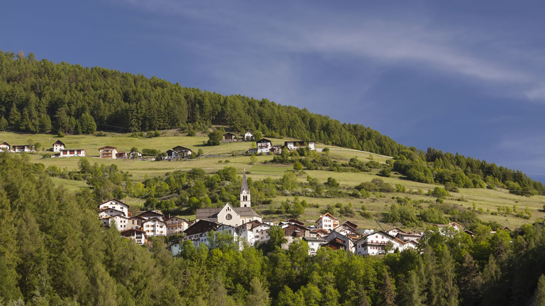
The Knapp village Stilfs is the destination of the Archaic Path in Vinschgau | © Vinschgau Marketing/Frieder Blickle
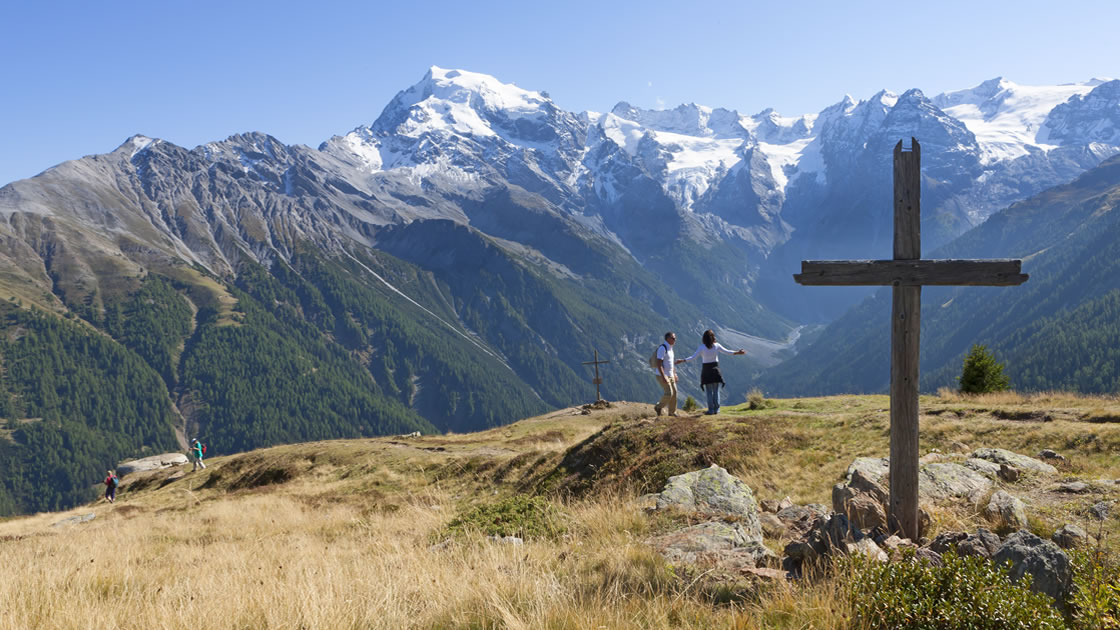
Up to the highest peaks in South Tyrol... The hiking routes in South Tyrol's Vinschgau Valley promise a holiday adventure.
The hiking routes in South Tyrol's Vinschgau Valley are particularly impressive for their richness of facets. Wild plays of colors invite active hikers to adventures at all altitudes in mild autumn temperatures - sometimes with more, sometimes with less alpine challenges. One of the hiking favorites, for example, is the Vinschger Höhenweg. It crosses the entire Vinschgau Valley once. The Archaic Trail, on the other hand, takes hikers back to prehistory and early history, and the scent of Kaiserschmarrn and Co. lures them to the "Lyfi Alm" in the Martell Valley. The traces of ancient irrigation channels can be followed on the Ilswaal. And finally, the meditative hourly path from monastery to monastery crosses the border into Switzerland.
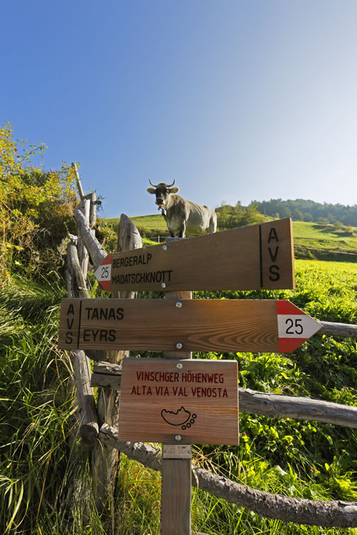
Vinschger Höhenweg
Unforgettable experiences on over 100 kilometers
On a total of 108 kilometers of footpaths and irrigation channels, the charming adventure trail leads once through the entire Vinschgau Valley. The six varied stages can be hiked individually or in one piece and can be easily mastered with good footwear. They have just as many special features in store for nature lovers as for friends of culture and culinary delights ... [more]
Archaikweg at the Stilfserjoch
Back to the roots
The Archaic Trail follows the former "Wormisionssteig", a prehistoric and early historic mule track. Narrow, sloping paths wind their way from the Stilfser bridge to Platzleid. People lived here as early as the Bronze Age - and the archaeological remains are visible on every stage: over a steep mountain path, for example, you reach the so-called "Weiberbödele", once a burnt offering site. This is followed by the "Rhaeto-Romanic village" of Stilfs, where artfully nested houses in steep terrain still bear witness to the skills of their builders. Afterwards, the "Kaschlin-Bühel" opens up, a settlement site of hunters and gatherers from Ötzi's times. It offers an unobstructed view of the Ortler group and post-glacial moraines. From the sunny slopes hikers march on to the Unterbrunn spring, until after about three hours they descend to the Agums mountain farms and to Prad.
Into the quiet Martell Valley
Tour to the "Lyfi Alm" in the Stilfserjoch National Park
The paths lead rather comfortably uphill to the rustic "Lyfi Alm", for the more demanding there are also more sporty variants. At the back of the Martell Valley, hikers at the 2,165-meter-high hut experience impressive views of the untouched nature of the Stilfserjoch National Park. Since fresh mountain air is known to make you hungry, guests of the "Lyfi Alm" enjoy not only the nature experience but also genuine Vinschgau specialties. The ingredients come mainly from local agriculture, the dishes are traditional and lovingly prepared. And on the wide panorama terrace dumplings, Schmarrn and apple strudel taste the same again so well. If you listen carefully, you may even hear a real marmot concert. Unlike most other mountain huts, you can also spend the night at the "Lyfi Alm" and end the evening with a fondue, for example.
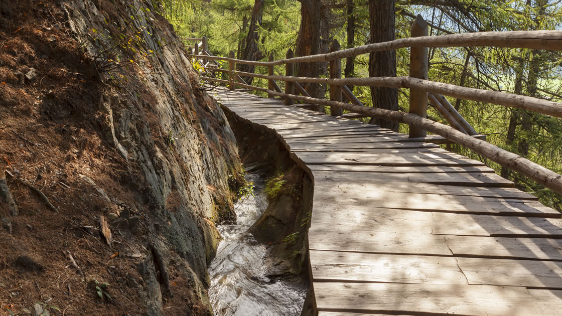
Water march! Walk along the Ilswaal
The approximately three-kilometer-long tour along the Ilswaal, which carries water from spring to fall, can be done in a good two hours. Nevertheless, there is plenty to discover along the old irrigation path, even for little hikers. The start is the sports zone in Silandro, followed by an ascent up to the Waalweg. The trail then continues on a straight stretch through forests, apple orchards and vineyards to the little St. Ägidius church. Somewhat more ambitious hikers have the option of extending the tour. At the rushing Schlandraunbach, where the Waalweg rises, another steep path leads up to Schlandersberg Castle (privately owned, cannot be visited).
Hourly path
Borderless and meditative
The 17-kilometer-long Hour Trail crosses borders from the South Tyrolean Upper Vinschgau to the Münstertal in Switzerland. The start and end points are marked by the Marienberg Monastery in Burgeis and the St. Johann Monastery in Müstair, a UNESCO World Heritage Site since 1983. The two Christian sites already give an idea of the character of the route: Far from civilization, Hour Trail hikers experience above all a journey to themselves. No restaurants, no hustle and bustle distract from the essentials, instead the (in-your-face) walkers encounter the culture, history, spirituality and nature of the region in a unique way with the help of 24 trail signs. Otherwise, peace and quiet remain the only companions on the path through the "magic" Rhaetian triangle. According to an old legend, the walk on the hour path not only has meditative purposes, but also purifies body, mind and soul. Overnight accommodations are available in both monasteries.
Waalweg Val Venosta
Val Venosta high trail
Hiking trails in Val Venosta
From the marble village of Laas to the fish pond of Brugg
One Hundred and One Ways: Crossing Boundaries and Going Within Yourself
Winter sports and snow fun in Roman footsteps
Autumn hiking on South Tyrol's sunny side
This map is loaded from ArcGIS. By loading you accept the privacy policy of ArcGIS.


